Digital Atlas of Natural Radiation

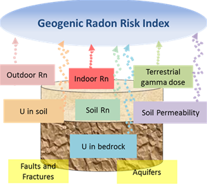
The human population is continuously exposed to ionizing radiation from several natural sources that can be classified in two categories:

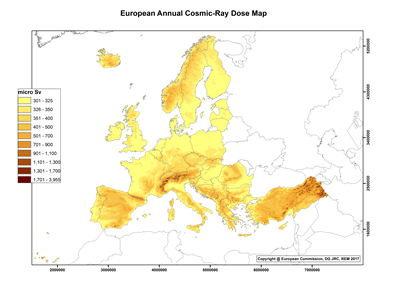
  • Cosmic contribution: high-energy cosmic rays incident on the Earth's atmosphere and releasing secondary radiation
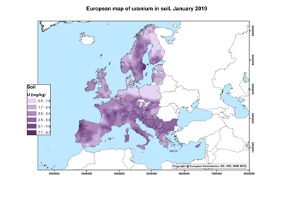
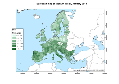
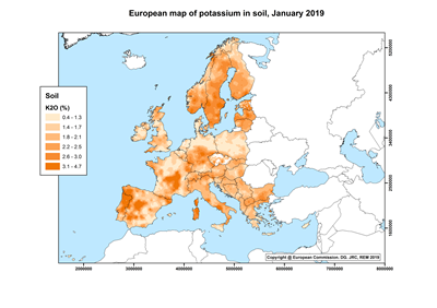
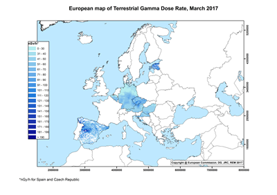
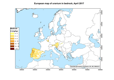
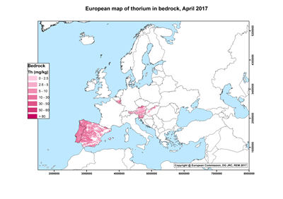
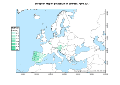
  • Terrestrial contribution: radioactive nuclides generated during the formation of the Earth and still present in the Earth's crust: mostly uranium and thorium radioactive families together with potassium (40K), which is a long-lived radioactive isotope of the elemental potassium. In most circumstances radon, a noble gas produced in the radioactive decay of the Uranium progeny, is the major contributor to the total dose.
The European Atlas of Natural Radiation

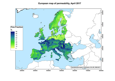
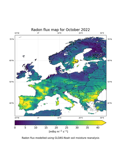
The European Atlas of Natural Radiation is a collection of maps displaying the levels of radioactivity caused by different natural sources in Europe.

The Atlas is intended to familiarise the public with the radioactive environment, to give a more balanced view of the annual dose that it may receive from natural radioactivity and to provide reference material and generate harmonised data for the scientific community. The overall goal of the Atlas is to estimate the annual dose that the public may receive from natural radioactivity, combining all the information from the different maps. Indeed, natural ionizing radiation is considered the largest contributor to the collective effective dose received by the world population.

The Atlas is developed and maintained by the Joint Research Centre of the European Commission.

Atlas Maps
    Annual cosmic-ray dose
  • Annual cosmic-ray dose

    The European Annual Cosmic-Ray Dose map reports the annual effective dose that a person may receive from photons, direct ionizing and neutron components of cosmic radiation at ground level.

    26/04/2017

    Cosmic
  • Indoor radon concentration
  • Indoor radon concentration

    The European Indoor Radon Map displays arithmetic means (AM) of annual indoor radon concentration in ground-floor rooms of dwellings over 10 km x 10 km grid cells.

    01/12/2020

    Indoor radon AM
  • Indoor radon - Number of measurements
  • Indoor radon - Number of measurements

    The European Indoor Radon Map displays the number of measurements (N) of annual indoor radon concentration in ground-floor rooms of dwellings over 10 km x 10 km grid cells.

    01/12/2020

    Indoor radon N
  • Uranium concentration in soil
  • Uranium concentration in soil

    The European uranium concentration in soil map displays the estimated concentration of uranium in soil over 10 km x 10 km grid cells.

    31/01/2019

    Uranium in soil
  • Thorium concentration in soil
  • Thorium concentration in soil

    The European thorium concentration in soil map displays the estimated concentration of thorium in soil over 10 km x 10 km grid cells.

    31/01/2019

    Thorium in soil
  • Potassium concentration in soil
  • Potassium concentration in soil

    The European potassium concentration in soil map displays the estimated concentration of potassium oxide (K2O) in soil over 10 km x 10 km grid cells.

    31/01/2019

    Potassium in soil
  • Terrestrial gamma dose
  • Terrestrial gamma dose

    The European Terrestrial Gamma Dose Rate map displays the gamma dose rate that a person may receive from terrestrial radiation.

    28/03/2017

    Terrestrial gamma
  • Uranium concentration in bedrock
  • Uranium concentration in bedrock

    The European uranium concentration in bedrock map displays the arithmetic mean (AM) of the concentration of uranium in bedrock over geological units.

    26/04/2017

    Uranium in bedrock
  • Thorium concentration in bedrock
  • Thorium concentration in bedrock

    The European thorium concentration in bedrock map displays the arithmetic mean (AM) of the concentration of thorium in bedrock over geological units.

    26/04/2017

    Thorium in bedrock
  • Potassium concentration in bedrock
  • Potassium concentration in bedrock

    The European potassium concentration in bedrock map displays the arithmetic mean (AM) of the concentration of potassium oxide (K2O) in bedrock over geological units.

    26/04/2017

    Potassium in bedrock
  • Soil permeability
  • Soil permeability

    The European map of soil permeability displays the percentage of topsoil fine fraction (<63 micro m). It is possible to derive a rough estimation of the permeability very easily from the weight percentage of fine fraction.

    26/04/2017

    Soil permeability
  • Geogenic radon
  • Geogenic radon

    The Geogenic Radon Map should display a variable which measures “what earth delivers” in terms of geogenic radon potential. WORK IN PROGRESS

    25/10/2016

    Geogenic radon
  • Radon flux
  • Radon flux

    Monthly maps display the radon flux from the earth for atmospheric tracer transport and radon protection analysis on a 0.05° x 0.05° grid.

    31/05/2023

    Radon flux